|
|
|
|
|
|
| "It's nice!" |
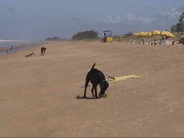
Guriri is located in
Săo Mateus, north of the Espírito Santo, Brazil. In their calm and crystalline
waters, during the low tide, there are famous natural swimming pools of
lukewarm waters, more than 40 Km of beach, where it is located one of
the main áreas de of sea turtles and of the Projeto Tamar.
The attractions of the place include, besides the two bars, the beach, forests and refuges to the edge of the rivers, small towns with
typical people, bars and restaurants close to the rivers or to the beach
where she can prove local delicacies as cooked crabs, fried fish, robalo fish stew, shrimps of all of the types and sizes and the most varied broths.
During the summer, in the square of the center of the neighborhood, it is
attended capoeira shows, musical bands and beauty contests.
But what really moves the life in the island are the tourism and the fishing.
Justifiable. And, as complement, it was honored with a climate of a lot of sun
that seems summer almost the whole year, providing, as they say the verses of
the local bands on the island, an own atmosphere for the love.
Attractions
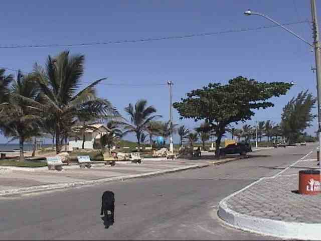
BEACHES
GURIRI-it is an island with a beach of almost 20 kilometers, calling the Beach
of New Barra. It possesses agitated and lukewarm waters forming natural swimming
pools in the low tide. Urbanized and enough frequented. TheCarnival, of
street, is one of the most lively of Espírito Santo coast. It is to 13 Km of Săo
Mateus's center with access in paved highway.
| "Long beaches here!" |
BARRA NOVA – MANGUEZAIS – -has a river of dark waters, it
polishes thick and gold, with a peculiar characteristic: the formation of stones
that are favor the sururu production.The extension is calculated
around 60Km. During the low tide it is possible to arrive of Indian for the
beach of Guriri. Another option is the dirt road of the Ranch, it is the right,
after Ponte of Mariricu, or to proceed of canoe for the growth of mangroves of
the Native. It possesses some small located bars. Distance = 23 Km of Săo Mateus.
URUÇUQUARA-it Begins in Rio Mariricu's mouth and it proceeds to the south for
more 15 Km. One of the most isolated passages of the coast capixaba. Beach
deserts, with limpid waters and good temperature. Frequented by surfers or
people that like peacefulness. It can be arrived by the beach in the low tide or
for the growth of mangroves of the Native, other option is for BR 101 in the Km
87. It is distant of the municipal district about 58 Km.
CACHOEIRA DO CRAVO -Old property of the Baron of Aymorés. The big house
was restored by the new proprietors. Formed by Rio Cricaré. It is placed to 03
Km of the headquarters of Nestor Gomes' District. Km 41 of the Highway Miguel C.
Carneiro (Săo Mateus X New Venécia).
CACHOEIRA DO INFERNO (WATERFALL OF THE HELL)-Ideal for ecological walks. Formed by the Cricaré
River. That name was given by the residents alleging a called well to
exist “Caldron of the Devil”. they Say that who she venture to dive doesn't
return to the surface. It is placed to 06 Km of the headquarters of Nestor
Gomes' District. Km 41 of the Highway Miguel C. Carneiro (Săo Mateus X New
Venécia).
PROJECT TAMAR-it Acts in the research, control and protection to the sea turtles.
The led off their activities in 1988 in the Beach of Guriri, 12 Km of Săo
Mateus's center. The spawning period begins in September, extending until March,
period of high season. An important local attraction is considered.
RIO SĂO MATEUS OR CRICARÉ-it is Born in the Mountain of the Sapphire in
Minas Gerais of the union of the rivers Xopotó and Piranga. It served for
long years as canal of the wealth of the municipal district. The fishing of the
robalo, had betrayed, piau and Jew besides shellfishes as crab, shrimp and pitu
is abundant. It is located to 500 downtown meters.
RIO MARIRICU- Also known like Maririke (called by the natives). Tributary of Rio
Săo Mateus or Cricaré. It is located in the Km 08 of the Highway Othovarino
Duarte Santos.
| "There are a lot of restaurantes and hotels here." |
RIO BLACK-Very known by tourists by possessing medicinal properties. Their
waters are dark. It possesses camping and close bar his/her margin. It is
located in the Km 06 of the Highway Othovarino Duarte Santos.
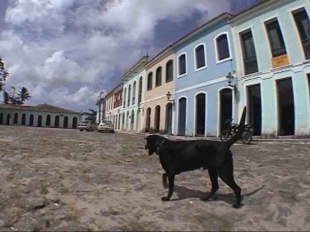
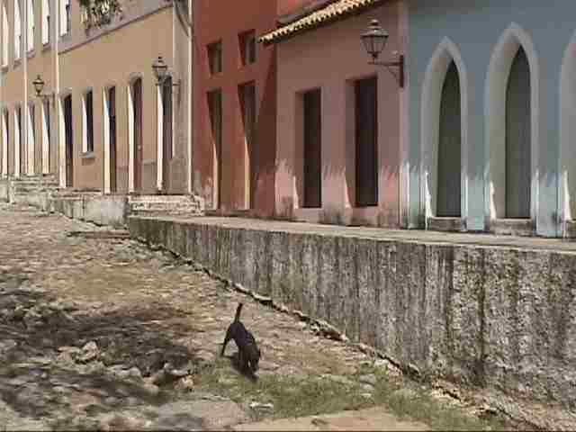
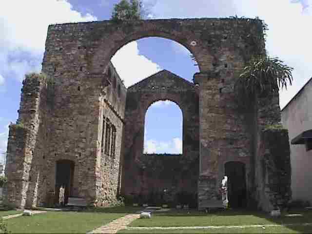
RUINS OF the OLD CHURCH-Built in 1596. Ruins of a temple built by Indian and
slaves. For his/her construction they were used stones that came as ballasts in
the embarkations and as supporter of the blocks, a league obtained with whale
oil and whitewash. Says the legend that they were hidden treasures in
their walls. It is located in the Praça Anchieta, Center.
CHURCH OF SĂO BENEDITO-Built the more than one century. Stage of folkloric and
religious events accomplished by devoted blacks in praise to the “Santo
Protetor”, in the month of December. Located in the Praça Săo Benedito, Center.
MOTHER CHURCH-Jesuit Construction of the oldest of the State and older of Săo
Mateus. In 1949 a fire that destroyed her happened partially. In 1751 it was
high to the Parish and today it is Diocese of Săo Mateus. Located in the
Municipal Square, Center.
CATHEDRAL OF SĂO MATEUS-Inaugurated in May of 1989. It possesses in the
interior beautiful sacred paintings of Cláudio Pastro. Located in the Avenida
Săo Joăo XXIII.
MONASTERY OF THE VIRGIN OF GUADELOUPE- Inaugurated in February of 1994. Busy for
nuns Beneditinas. Opened daily to you visit. It possesses masses with Gregorian
song. Located in BR 101, Km 67,5.
| "Beautifull!" |
OLD HOUSE OF THE PIECE OF ADVICE-Built in 1765 to shelter the headquarters of
Municipal Council. Until the end of the decade of 80 the Municipal City hall
worked. In the inferior part of the building the prison worked. Now it is used
as headquarters of the Municipal General office of Education. It is placed at
the Municipal Square, Center.
The FATHER OF ALL (MARCO DEMARCATÓRIO)-it is at the place since October 03,
1764. Demarcation of lands donated for the patrimony and income of Council,
according to Royal Letter of March 03, 1755. Located in the root of the slope
that ties Porto (City Lowers) to the Municipal Square (High City).
RIO CRICARÉ OR RIVER are MATEUS-it is Born in the Mountain of the Sapphire, in
Minas Gerais. Has an extension of 188 kilometers, 104 of them in
the Espírito Santo State. The fishing is the only economical activity. Their waters
are green and calms. It possesses a beautiful vegetation at dusk in the
margin and a beautiful look.
WATERSPOUT-Historical Patrimony of Săo Mateus, built in 1880. For a long time it
supplied drinking water the community mateense, in Porto. Now it assists the
residents of the proximities. Located in the Avenida Cricaré, close the Slope of
Bezouro.
| "Old stuff" |
FARINHEIRAS (QUITUNGOS)-they were responsible for the prominence position
occupied by the municipal district at national level, in the times of the export
of the manioc flour. They were introduced in the periods Colonial and Imperial
of Brazil. It still today exists dozens of them dispersed for Săo Mateus. The
ones that more they stand out are the one of the Comunidade Espírito Santo. The
access is for ground highway, with entrance in the Km 80 of BR 101.
PORTO OF SĂO MATEUS-THE Historical Ranch Porto of Săo Mateus reflects Săo
Mateus's importance in the century passed with his/her powerful rural
aristocracy that it produced and it exported flour, coffee, wood etc. For him
the enslaved blacks arrived. Their descendants form 70% of the population
mateense today. The big houses began to appear in 1636 and they reflect the
wealth and decadence of a golden time. Remained them appeared in the Cycle of
the Flour in 1770. It was tumbled by State Council of Culture in the decade of
70. It is located in the low part of the city. It exists four access roads
to the place, three slopes, one of them the one of Săo Gonçalo, and a road that
borders Rio Cricaré.
It is WORTH OF CRICARÉ-Group paisagístico of rare beauty. Distant downtown 500
meters. Frequently happens the flight of herons.
| "Piece" |
|
Tips by GUSTAVO VIVACQUA |
|
1.The carnival, already recognized nationally the one of the biggest, presents shows and music a lot 2.Who go to New Barra, for a narrow highway of earth, to 27 Km of the center of the neighborhood, will see one of the more beautiful women, local landscapes, besides appreciating, in the full tide in the morning, the exit of the fishing boats for the sea and, in the middle of the afternoon, and the return. 3.You can rent a kayak and to row for the estuary. 4.Go to an unit of the Projeto Tamar, of protection to the turtles, open to the visitation. 5.Best time to visit: December to February. 6.Go to the historical ranch, it is very beautiful |
CLICK HERE to send your tip
CLICK HERE TO SEE OTHER BRAZILIAN DESTINATIONS

![]()